On the way to decleration: Kohlstatt - Aigen-Schlägl, 20 km


- Possible accommodation
Interactive elevation profile
Create PDF
Tour-Details
Path number: Gelbe Schilder mit Entschleunigungs-Symbol
Starting place: 4162 Julbach
Destination: 4160 Aigen-Schlägl
duration: 5h 15m
length: 20,4 km
Altitude difference (uphill): 170m
Altitude difference (downhill): 360m
Lowest point: 550m
Highest point: 740m
difficulty: medium
condition: medium
panoramic view: Great panorama
Paths covering:
Asphalt, Gravel, Hiking trail, Other
powered by TOURDATA
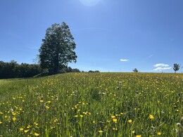
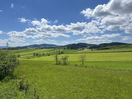
Stage: Kohlstatt - Aigen-Schlägl, 20 km Hiking opens up completely new forms of encounters with people and animals along the way. A week of hiking along the path of deceleration will remain a vivid memory for a long time.
Recharge your batteries with the special radiation of the granite, let the voices in your head be drowned out by the sound of the streams and "bathe" in the healthy forest air.
You can find the digital route in the App Komoot.
On request, we will also be happy to provide you with a detailed description of the stage. This is also available for download under Multimedia/Documents.
With the free outdooractive app, you can hike the route using navigation.
further information:
- Possible accommodation
- Experience of nature
- Board possible
Details - hiking
- themed path
- Suitable for single travelers
- Suitable for couples
- Spring
- Summer
- Autumn
Please get in touch for more information.
Schulstraße 4
4162 Julbach
Phone +43 5 7890 - 100
Fax machine +43 5 7890 - 115
E-Mail info@boehmerwald.at
Web www.wegderentschleunigung.at
https://www.wegderentschleunigung.at
You can also visit us on
Visit us on Facebook Visit us on Instagram Visit our videochannel on YouTubeInteractive elevation profile
Create PDF
Tour-Details
Path number: Gelbe Schilder mit Entschleunigungs-Symbol
Starting place: 4162 Julbach
Destination: 4160 Aigen-Schlägl
duration: 5h 15m
length: 20,4 km
Altitude difference (uphill): 170m
Altitude difference (downhill): 360m
Lowest point: 550m
Highest point: 740m
difficulty: medium
condition: medium
panoramic view: Great panorama
Paths covering:
Asphalt, Gravel, Hiking trail, Other
powered by TOURDATA
