On the way to decleration: Holzschlag / Klaffer - Hintenberg / Ulrichsberg, 16 km


- Possible accommodation
Interactive elevation profile
Create PDF
Tour-Details
Path number: Gelbe Schilder mit Entschleunigungs-Symbol
Starting place: 4163 Klaffer am Hochficht
Destination: 4161 Ulrichsberg
duration: 4h 27m
length: 15,5 km
Altitude difference (uphill): 460m
Altitude difference (downhill): 680m
Lowest point: 660m
Highest point: 1.250m
difficulty: medium
condition: medium
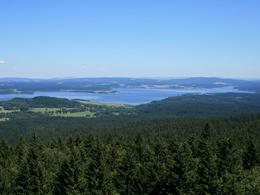
panoramic view: Great panorama
Paths covering:
Asphalt, Path / trail, Hiking trail, Other
powered by TOURDATA
Stage: Holzschlag - Hintenberg, 16 km
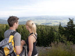
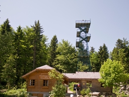
The trail leads across the slopes of the Hochficht ski area to the Stinglfelsen rock with a fantastic view! Through beautiful forests you reach Schöneben and the Moldaublick, which offers a view over Bohemia and the Vltava reservoir. From here, the route leads downhill to today's stage destination Hintenberg.You can find the route digitally in the App Komoot.
On request, we will also be happy to provide you with a detailed description of the stage. This is also available for download under Multimedia/Documents.
With the free outdooractive app, you can hike the route using navigation.
further information:
- Possible accommodation
- Experience of nature
- Board possible
Details - hiking
- themed path
- Suitable for single travelers
- Suitable for couples
- Spring
- Summer
- Autumn
Please get in touch for more information.
Dorfplatz 1
4163 Klaffer am Hochficht
Phone +43 5 7890 - 100
Fax machine +43 5 7890 - 115
E-Mail info@boehmerwald.at
Web www.wegderentschleunigung.at
https://www.wegderentschleunigung.at
You can also visit us on
Visit us on Facebook Visit us on Instagram Visit our videochannel on YouTubeInteractive elevation profile
Create PDF
Tour-Details
Path number: Gelbe Schilder mit Entschleunigungs-Symbol
Starting place: 4163 Klaffer am Hochficht
Destination: 4161 Ulrichsberg
duration: 4h 27m
length: 15,5 km
Altitude difference (uphill): 460m
Altitude difference (downhill): 680m
Lowest point: 660m
Highest point: 1.250m
difficulty: medium
condition: medium
panoramic view: Great panorama
Paths covering:
Asphalt, Path / trail, Hiking trail, Other
powered by TOURDATA
