On the way to decleration: Kohlstatt - Schwarzenberg, 20 km


- Possible accommodation
Interactive elevation profile
Create PDF
Tour-Details
Path number: Gelbe Schilder mit Entschleunigungs-Symbol
Starting place: 4162 Julbach
Destination: 4164 Schwarzenberg am Böhmerwald
duration: 5h 17m
length: 20,1 km
Altitude difference (uphill): 320m
Altitude difference (downhill): 323m
Lowest point: 590m
Highest point: 740m
difficulty: medium
condition: medium
panoramic view: Great panorama
Paths covering:
Asphalt, Hiking trail
powered by TOURDATA
Stage: Kohlstatt - Schwarzenberg, 20 km
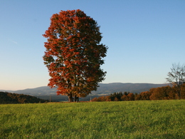
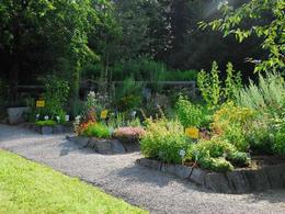
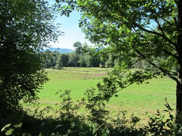
The trail follows the Bavarian border for a short distance via the Feslhöhe, where a beautiful view awaits the hiker. A bench under the large maple tree invites you to take a break. The trail continues via the golf park to Klaffer, where the herb garden invites you to visit. The trail now runs across meadows and through varied deciduous and coniferous forests. In Schwarzenberg, a museum provides information about the great son of the Bohemian Forest, the poet Adalbert Stifter.The route can be found digitally in the App Komoot.
On request, we will also be happy to provide you with a detailed description of the stage. This is also available for download under Multimedia/Documents.
With the free outdooractive app, you can hike the route using navigation.
further information:
- Possible accommodation
- Experience of nature
- Board possible
Details - hiking
- themed path
- Suitable for single travelers
- Suitable for couples
- Spring
- Summer
- Autumn
Please get in touch for more information.
Schulstraße 4
4162 Julbach
Phone +43 5 7890 - 100
Fax machine +43 5 7890 - 115
E-Mail info@boehmerwald.at
Web www.wegderentschleunigung.at
https://www.wegderentschleunigung.at
You can also visit us on
Visit us on Facebook Visit us on Instagram Visit our videochannel on YouTubeInteractive elevation profile
Create PDF
Tour-Details
Path number: Gelbe Schilder mit Entschleunigungs-Symbol
Starting place: 4162 Julbach
Destination: 4164 Schwarzenberg am Böhmerwald
duration: 5h 17m
length: 20,1 km
Altitude difference (uphill): 320m
Altitude difference (downhill): 323m
Lowest point: 590m
Highest point: 740m
difficulty: medium
condition: medium
panoramic view: Great panorama
Paths covering:
Asphalt, Hiking trail
powered by TOURDATA
