On the way to deceleration: Peilstein - Kohlstatt, 19 km
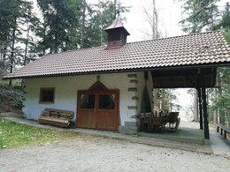


- Possible accommodation
Interactive elevation profile
Create PDF
Tour-Details
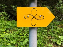
Path number: Gelbe Schilder mit Entschleunigungs-Symbol
Starting place: 4153 Peilstein im Mühlviertel
Destination: 4162 Julbach
duration: 5h 19m
length: 19,7 km
Altitude difference (uphill): 560m
Altitude difference (downhill): 390m
Lowest point: 540m
Highest point: 770m
difficulty: medium
condition: medium
panoramic view: Great panorama
Paths covering:
Asphalt, Path / trail, Gravel, Hiking trail
powered by TOURDATA
Peilstein – Kohlstatt 19 km
Through the valley of the Kleine Mühl via Julbach - the Meran of the Mühlviertel - you reach Kohlstatt on the border with Bavaria.
Attention: At the end of the stage, it is not possible to spend the night in Kohlstatt! Alternative overnight stay twice in Schwarzenberg - pick-up and transfer from: Hotel Bergkristall OR Alternative overnight stay in Aigen-Schlägl - pick-up and transfer from: Biergasthaus Schiffner, Hotel Bärnsteinhof, Villa Nikola.
You can find the route digitally in the App Komoot.
On request, we will also be happy to provide you with a detailed description of the stage. This is also available for download under Multimedia/Documents.
With the free outdooractive app, you can hike the route using navigation.
further information:
- Possible accommodation
- Experience of nature
- Board possible
Details - hiking
- themed path
- Suitable for single travelers
- Suitable for couples
- Spring
- Summer
- Autumn
Please get in touch for more information.
Markt 7
4160 Aigen-Schlägl
Phone +43 5 7890 - 100
Fax machine +43 5 7890 - 115
E-Mail info@boehmerwald.at
Web www.wegderentschleunigung.at
https://www.wegderentschleunigung.at
You can also visit us on
Visit us on Facebook Visit us on Instagram Visit our videochannel on YouTubeInteractive elevation profile
Create PDF
Tour-Details
Path number: Gelbe Schilder mit Entschleunigungs-Symbol
Starting place: 4153 Peilstein im Mühlviertel
Destination: 4162 Julbach
duration: 5h 19m
length: 19,7 km
Altitude difference (uphill): 560m
Altitude difference (downhill): 390m
Lowest point: 540m
Highest point: 770m
difficulty: medium
condition: medium
panoramic view: Great panorama
Paths covering:
Asphalt, Path / trail, Gravel, Hiking trail
powered by TOURDATA
