
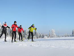
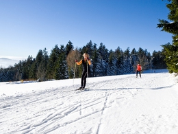
Grünwald trail


- Possible accommodation
Interactive elevation profile
Create PDF
Tour-Details
Path number: 10
Starting place: 4160 Aigen-Schlägl
Destination: 4160 Aigen-Schlägl
duration: 0h 30m
length: 3,8 km
Altitude difference (downhill): 111m
Lowest point: 856m
Highest point: 967m
difficulty: medium
condition: medium
panoramic view: Some Views
Paths covering:
snow
powered by TOURDATA
Trail not in operation
Northern Bohemian Forest centre - access Grünwald or Oberhaag
Grünwald trail, 3.8 km, P+S, connection between Grünwald and Oberhaag
Card machine for day tickets: don't forget your coins (no change will be returned)!
We would be happy to add you to our mailing list for the daily trail report - just send us a short email:
boehmerwald@muehlviertel.at
Starting point: Oberhaag or Grünwald.
Destination: Oberhaag or Grünwald.
further information:
- Possible accommodation
- Board possible
Details - Trail
- Nordic skiing facilities: Marked Nordic skiing run
- Type of Nordic skiing run: Classic + skating
In winter, depending on snow conditions and weather.
Parking
- Parking space: 50
Parking free of charge.
Most economical season
- Deep winter
Please get in touch for more information.
Dreisesselbergstraße 18
4160 Aigen-Schlägl
Phone +43 5 07263 - 200
E-Mail boehmerwald@muehlviertel.at
Web www.muehlviertel.at/
https://www.muehlviertel.at/
You can also visit us on
Visit us on Facebook Visit us on Instagram Visit our videochannel on YouTube
")
")
")
Interactive elevation profile
Create PDF
Tour-Details
Path number: 10
Starting place: 4160 Aigen-Schlägl
Destination: 4160 Aigen-Schlägl
duration: 0h 30m
length: 3,8 km
Altitude difference (downhill): 111m
Lowest point: 856m
Highest point: 967m
difficulty: medium
condition: medium
panoramic view: Some Views
Paths covering:
snow
powered by TOURDATA
