
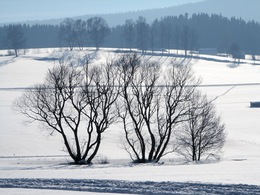
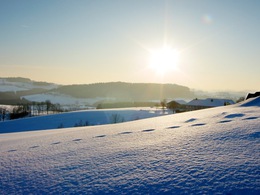
Winterwanderweg: Klafferrunde


- Flatly
- Possible accommodation
Interactive elevation profile
Create PDF
Tour-Details
Starting place: 4163 Klaffer am Hochficht
Destination: 4163 Klaffer am Hochficht
duration: 1h 0m
length: 3,6 km
Altitude difference (uphill): 38m
Altitude difference (downhill): 33m
Lowest point: 604m
Highest point: 632m
difficulty: easy
condition: easy
panoramic view: Some Views
Paths covering:
snow
powered by TOURDATA
A sunny winter hiking trail on streets with light traffic and country roads.
Use the free outdooractive app to navigate the route.
further information:
- Flatly
- Possible accommodation
- Board possible
Details - hiking
- cleared winter hiking path
Parking
- Parking space: 10
Most economical season
- Deep winter
Please get in touch for more information.
Dorfplatz 1
4163 Klaffer am Hochficht
Phone +43 5 07263 - 200
E-Mail boehmerwald@muehlviertel.at
Web www.muehlviertel.at/
https://www.muehlviertel.at/
You can also visit us on
Visit us on Facebook Visit us on Instagram Visit our videochannel on YouTube")
Interactive elevation profile
Create PDF
Tour-Details
Starting place: 4163 Klaffer am Hochficht
Destination: 4163 Klaffer am Hochficht
duration: 1h 0m
length: 3,6 km
Altitude difference (uphill): 38m
Altitude difference (downhill): 33m
Lowest point: 604m
Highest point: 632m
difficulty: easy
condition: easy
panoramic view: Some Views
Paths covering:
snow
powered by TOURDATA
