Kohlstattrunde


- Flatly
- Possible accommodation
Interactive elevation profile
Create PDF
Tour-Details
Path number: 9
Starting place: 4162 Julbach
Destination: 4162 Julbach
duration: 5h 0m
length: 14,8 km
Altitude difference (uphill): 421m
Altitude difference (downhill): 425m
Lowest point: 539m
Highest point: 783m
difficulty: medium
condition: medium
panoramic view: Great panorama
Paths covering:
Asphalt, Hiking trail
powered by TOURDATA
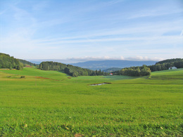
A hike with great views of the Bohemian Forest vacation area.
1.6 km road Julbach-Bräuerau and turn into the goods road, which branches off to the right here and then leads uphill. You will reach a chapel, where you continue to the left. You pass the Böhmerwald Golf Park (marvellous view of the Böhmerwald) on the edge. The path now leads through the forest and after ...
3.3 km you come to the Julbach-Bräuerau road. Turn left. Shortly afterwards, at the waiting hut, turn right towards Kleinsagberg. Cross the Kleine Mühl and then continue uphill to the right on the tarmac road until you reach the ...
4.0 km scattered settlement of Kleinsagberg. Always following the signs, you cross the forest, which then leads into a meadow path. On the right, you will see the Grenzlandmilchhof (4 farmers have joined forces to jointly manage their farms). However, turn left and head towards the forest. The path leads through a beautiful beech forest, which then takes you to the "Pomeissling" - an enchanting clearing - where the plant beds of the surrounding farms used to be.
You cross this and enter an exemplary plenter forest: mixed forest with trees of all stages of development next to each other. By felling only individual trunks, more light is allowed to enter and thus natural regeneration is possible.
7.0 km You reach the Schiffler Chapel. In 1880, a chapel was built in place of the old Schiffler image, a Mother of God image, to which pilgrimages to this place of power had always been organised. Now walk for 15 minutes on a stretch of tarmac to ...
8.0 km Kohlstatt. Here you can enjoy a magnificent view of Bavaria and the Bohemian Forest. You have now completed half of the hike. The name Kohlstatt comes from Köhlerstätte, which means that charcoal was burnt in kilns here. Following the signs, you hike alternately on forest and meadow paths until you reach the ...
9.4 km Waldkaiser. There the path joins a small road with little traffic. After approx. 300 m, turn left and follow the path, which after a section of forest leads into a gravel farm track, which you follow to ...
11.3 km Hinterschiffl. Here you meet the Guckerweg (path no. 7). However, take the path left in the opposite direction to the Guckerweg. After a short tarmac section, you will see the Gucker station "Streusiedlung Heinrichsberg". Here the path joins the dirt track on the right. Continue along this path. You will reach the next peeper stations "Böhmerwaldblick" and "Julbachblick". The rest of the way you will be rewarded with marvellous views of Julbach, the Zwischenmühl ridge and the Bohemian Forest. Always downhill to the crossing of the ...
14.3 km of the Kleine Mühl river. Now uphill across the meadow to the ...
14.8 km starting point Julbach.
Request our hiking map for EUR 3.00!
With the free app outdooractive you can hike the trail by navigation.
Most economical season
- Spring
- Summer
- Autumn
Please get in touch for more information.
Schulstraße 4
4162 Julbach
Phone +43 5 07263 - 200
E-Mail boehmerwald@muehlviertel.at
Web www.muehlviertel.at/
https://www.muehlviertel.at/
You can also visit us on
Visit us on Facebook Visit us on Instagram Visit our videochannel on YouTubeInteractive elevation profile
Create PDF
Tour-Details
Path number: 9
Starting place: 4162 Julbach
Destination: 4162 Julbach
duration: 5h 0m
length: 14,8 km
Altitude difference (uphill): 421m
Altitude difference (downhill): 425m
Lowest point: 539m
Highest point: 783m
difficulty: medium
condition: medium
panoramic view: Great panorama
Paths covering:
Asphalt, Hiking trail
powered by TOURDATA


