Steep step path - large round


- culturally interesting
- Flatly
- Possible accommodation
Interactive elevation profile
Create PDF
Tour-Details
Path number: 78
Starting place: 4170 Haslach an der Mühl
Destination: 4170 Haslach an der Mühl
duration: 5h 0m
length: 16,5 km
Altitude difference (uphill): 410m
Altitude difference (downhill): 410m
Lowest point: 496m
Highest point: 714m
difficulty: medium
condition: medium
panoramic view: Great panorama
Paths covering:
Asphalt, Hiking trail
powered by TOURDATA
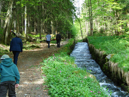
Hiking trail to the scarps of the Schwarzenbergischer Schwemmkanals (Schwarzenberg log flume).
0 km Marketplace Haslach. From the marketplace to the Old Tower, continue to the main road - cross it, straight ahead on the mountain road, after approx. 200 m turn left towards Jaukenberg.
1.6 km View to Haslach and to Lichtenau Castle and Rohrbach-Berg. Continue on the road to Jaukenberg through the Bärenholz past the Nußbaumerhof and along the meadow path to ...
3.9 km Zarghof. Past the farm, on the tarmac road downhill towards Unterurasch. After the bridge, continue right along the Zwettlbach stream to the bee hut. Shortly after the bee hut, turn left up the slope. After a short walk you come to a track, continue right here, slightly hilly through the forest. Shortly before you come out of the forest, cross the ditch on the right and walk up the opposite slope. Continue to the left at a right angle along the meadow path and then branch off to the right towards the forest. From there, the trail descends steeply to the ...
6.6 km boundary stone, which was set during the mapping and demarcation of the border under Joseph II, and on to the steep steps of the Schwarzenberg alluvial canal. When the snow melted, the logs tumbled down the riverbed with a thunderous roar. It was one of the most dangerous places for alluvial fans, because if the wood became wedged here, the following logs were often hurled metres into the air.
7.7 km At the rest area cross the Morau to St. Oswald. Oswald.
9.2 km In St. Oswald walk downhill on the road to Almesberg, continue along the meadow path to Schwackerreith and then on the road to ...
11.5 km Furtmühle. Old trade routes crossed here. One led here from Aigen along the Große Mühl, the more important one was a salt route, the connection between Rohrbach and South Bohemia.
A toll station was set up at the Furtmühle. Cross the Große Mühl and turn left along the river onto a meadow path. A very beautiful path then begins at the edge of the forest, which you follow along the Große Mühl to the ...
15.6 km Cranzling Recreation Centre and on to ...
16.5 km Haslach an der Mühl back.
Request our hiking map for EUR 3.00.
With the free outdooractive app, you can hike the trail using navigation.
Starting point: Market square Haslach an der Mühl.
Destination: Market square Haslach an der Mühl.
further information:
- Flatly
- Possible accommodation
- Board possible
Most economical season
- Spring
- Summer
- Autumn
Please get in touch for more information.
Stahlmühle 4
4170 Haslach an der Mühl
Phone +43 5 7890 - 100
Fax machine +43 5 7890 - 115
E-Mail info@boehmerwald.at
Web www.boehmerwald.at/
https://www.boehmerwald.at/
You can also visit us on
Visit us on Facebook Visit us on Instagram Visit our videochannel on YouTube")
")
")
")
")
")
")
")

")
Interactive elevation profile
Create PDF
Tour-Details
Path number: 78
Starting place: 4170 Haslach an der Mühl
Destination: 4170 Haslach an der Mühl
duration: 5h 0m
length: 16,5 km
Altitude difference (uphill): 410m
Altitude difference (downhill): 410m
Lowest point: 496m
Highest point: 714m
difficulty: medium
condition: medium
panoramic view: Great panorama
Paths covering:
Asphalt, Hiking trail
powered by TOURDATA
