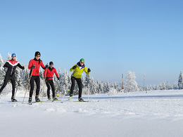
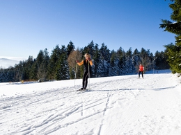
Grünwald trail


- Possible accommodation
Interactive elevation profile
Create PDF
Tour-Details
Path number: 10
Starting place: 4160 Aigen-Schlägl
Destination: 4160 Aigen-Schlägl
duration: 0h 30m
length: 3,8 km
Altitude difference (downhill): 111m
Lowest point: 856m
Highest point: 967m
difficulty: medium
condition: medium
panoramic view: Some Views
Paths covering:
snow
powered by TOURDATA
Trail not in operation
Northern Bohemian Forest centre - access Grünwald or OberhaagGrünwald trail, 3.8 km, P+S, connection between Grünwald and Oberhaag
Card machine for day tickets: don't forget your coins (no change will be returned)! The number of groomed kilometres and open trails as well as the snow depth and condition of the trails can be found in the trail report!
Request our free trail map here!
We would be happy to add you to our mailing list for the daily cross-country ski trail report - just send us a short email: info@boehmerwald.at!
Starting point: Oberhaag or Grünwald.
Destination: Oberhaag or Grünwald.
further information:
- Possible accommodation
- Board possible
Details - Trail
- Nordic skiing facilities: Marked Nordic skiing run
- Type of Nordic skiing run: Classic + skating
In winter, depending on snow conditions and weather.
Parking
- Parking space: 50
Parking free of charge.
Most economical season
- Deep winter
Please get in touch for more information.
Hauptstraße 2
4160 Aigen-Schlägl
Phone +43 5 7890 - 100
Fax machine +43 5 7890 - 115
E-Mail info@boehmerwald.at
Web www.boehmerwald.at
https://www.boehmerwald.at
You can also visit us on
Visit us on Facebook Visit us on Instagram Visit our videochannel on YouTube
")
")
")
Interactive elevation profile
Create PDF
Tour-Details
Path number: 10
Starting place: 4160 Aigen-Schlägl
Destination: 4160 Aigen-Schlägl
duration: 0h 30m
length: 3,8 km
Altitude difference (downhill): 111m
Lowest point: 856m
Highest point: 967m
difficulty: medium
condition: medium
panoramic view: Some Views
Paths covering:
snow
powered by TOURDATA
