On the way to decleration: Aigen-Schlägl - Haslach, 19 km


- culturally interesting
- Possible accommodation
Interactive elevation profile
Create PDF
Tour-Details
Path number: Gelbe Schilder mit Entschleunigungs-Symbol
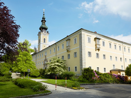
Starting place: 4160 Aigen-Schlägl
Destination: 4170 Haslach an der Mühl
duration: 5h 3m
length: 18,9 km
Altitude difference (uphill): 340m
Altitude difference (downhill): 350m
Lowest point: 500m
Highest point: 760m
difficulty: medium
condition: medium
panoramic view: Great panorama
Paths covering:
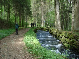
Asphalt, Hiking trail
powered by TOURDATA
Aigen-Schlägl – Haslach
19 km, walking distance approx. 4.5 h, approx. 420 m difference in altitude
The stage leads to a contemporary witness of the 18th century - the steep step at the Schwarzenberg alluvial canal. If you listen carefully, you can still hear the logs rumbling through the canal.
You can find the route digitally in the App Komoot.
On request, we will also be happy to provide you with a detailed description of the stage. This is also available for download under Multimedia/Documents.
With the free outdooractive app, you can hike the route using navigation.
further information:
- Possible accommodation
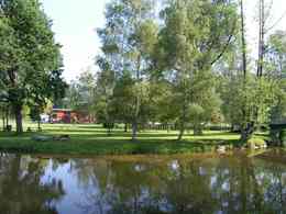
- Experience of nature
- Board possible
Details - hiking
- themed path
- Suitable for seniors
- Suitable for single travelers
- Suitable for couples
- Spring
- Summer
- Autumn
Please get in touch for more information.
Hauptstraße 2
4160 Aigen-Schlägl
Phone +43 5 7890 - 100
Fax machine +43 5 7890 - 115
E-Mail info@boehmerwald.at
Web www.wegderentschleunigung.at
https://www.wegderentschleunigung.at
You can also visit us on
Visit us on Facebook Visit us on Instagram Visit our videochannel on YouTubeInteractive elevation profile
Create PDF
Tour-Details
Path number: Gelbe Schilder mit Entschleunigungs-Symbol
Starting place: 4160 Aigen-Schlägl
Destination: 4170 Haslach an der Mühl
duration: 5h 3m
length: 18,9 km
Altitude difference (uphill): 340m
Altitude difference (downhill): 350m
Lowest point: 500m
Highest point: 760m
difficulty: medium
condition: medium
panoramic view: Great panorama
Paths covering:
Asphalt, Hiking trail
powered by TOURDATA
