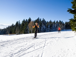
Christian Hoffmann cross-country ski run


- Flatly
- Possible accommodation
Interactive elevation profile
Create PDF
Tour-Details
Path number: CH
Starting place: 4160 Aigen-Schlägl
Destination: 4160 Aigen-Schlägl
duration: 2h 0m
length: 13,2 km
Altitude difference (uphill): 151m
Altitude difference (downhill): 150m
Lowest point: 946m
Highest point: 1.035m
difficulty: medium
condition: medium
panoramic view: Some Views
Paths covering:
snow
powered by TOURDATA
Trail not in operation
Nordisches Zentrum Böhmerwald - Grünwald entranceChristian Hoffmann trail, 13.2 km, P + S
Ticket machine for day tickets: don't forget your coins (no change will be returned)!This trail is dedicated to the Olympic champion Christian Hoffmann, who made his first cross-country tracks here. The number of groomed kilometres and open trails as well as the snow depth and condition of the trails can be found in the trail report!
Request our free trail map here!
We would be happy to add you to our mailing list for the daily trail report - just send us a short email: info@boehmerwald.at!
Starting point: (Verb. Grünwald-Schöneben), starting point Grünwald or Schöneben.
Destination: (Grünwald-Schöneben link), starting point Grünwald or Schöneben.
further information:
- Flatly
- Possible accommodation
- Board possible
Details - Trail
- Nordic skiing facilities: Marked Nordic skiing run
- Type of Nordic skiing run: Classic + skating
- locker
In winter, depending on snow conditions and weather.
Parking
- Parking space: 50
Parking free of charge.
Most economical season
- Deep winter
Please get in touch for more information.
Hauptstraße 2
4160 Aigen-Schlägl
Phone +43 5 7890 - 100
Fax machine +43 5 7890 - 115
E-Mail info@boehmerwald.at
Web www.boehmerwald.at
https://www.boehmerwald.at
You can also visit us on
Visit us on Facebook Visit us on Instagram Visit our videochannel on YouTube")
")
")
")
Interactive elevation profile
Create PDF
Tour-Details
Path number: CH
Starting place: 4160 Aigen-Schlägl
Destination: 4160 Aigen-Schlägl
duration: 2h 0m
length: 13,2 km
Altitude difference (uphill): 151m
Altitude difference (downhill): 150m
Lowest point: 946m
Highest point: 1.035m
difficulty: medium
condition: medium
panoramic view: Some Views
Paths covering:
snow
powered by TOURDATA
