Petersbergrunde


- Flatly
Interactive elevation profile
Create PDF
Tour-Details
Starting place: 4172 St. Johann am Wimberg
Destination: 4172 St. Johann am Wimberg
duration: 2h 38m
length: 9,4 km
Altitude difference (uphill): 171m
Altitude difference (downhill): 176m
Lowest point: 673m
Highest point: 808m
difficulty: medium
condition: medium
panoramic view: Great panorama
Paths covering:
Asphalt, Gravel, Hiking trail
powered by TOURDATA
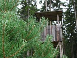
This hiking trail leads past large farms with marvellous views of the "Steinerne Mühl" valley and the Czech and Bavarian borders.
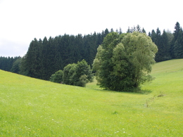
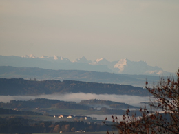
A wonderful hiking trail with "highs and lows". From St. Johann, the trail leads uphill on a goods road. It's worth taking a look back, you can see the village of St. Johann and, on a clear day, as far as the Alps. After leaving the goods road, the route descends along a beautiful forest hiking trail to the Hummelmühlbach stream. After a somewhat strenuous ascent, you are rewarded with a marvellous view. Take your time, take a deep breath and enjoy. From there, it's back to St. Johann.
With the free outdooractive app, you can hike the trail using navigation.
Most economical season
- Spring
- Summer
- Autumn
- Early winter
Please get in touch for more information.
St. Johann 10
4172 St. Johann am Wimberg
Phone +43 7217 7155
E-Mail gemeinde@stjohannamwimberg.at
Web www.stjohannamwimberg.at
https://www.stjohannamwimberg.at
You can also visit us on
Visit us on Facebook Visit us on Instagram Visit our videochannel on YouTubeInteractive elevation profile
Create PDF
Tour-Details
Starting place: 4172 St. Johann am Wimberg
Destination: 4172 St. Johann am Wimberg
duration: 2h 38m
length: 9,4 km
Altitude difference (uphill): 171m
Altitude difference (downhill): 176m
Lowest point: 673m
Highest point: 808m
difficulty: medium
condition: medium
panoramic view: Great panorama
Paths covering:
Asphalt, Gravel, Hiking trail
powered by TOURDATA
