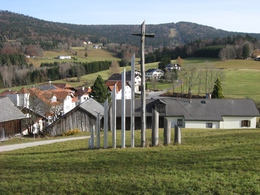
Marientalrunde


- Suitable for pushchairs
- Flatly
- Possible accommodation
Interactive elevation profile
Create PDF
Tour-Details
Path number: 60
Starting place: 4164 Schwarzenberg am Böhmerwald
Destination: 4164 Schwarzenberg am Böhmerwald
duration: 1h 30m
length: 5,0 km
Altitude difference (uphill): 100m
Altitude difference (downhill): 101m
Lowest point: 642m
Highest point: 740m
difficulty: easy
condition: easy
panoramic view: Great panorama
Paths covering:
Asphalt, Hiking trail
powered by TOURDATA
Beautiful hike for families.
0 km You start the hike at the Gemeindeamt Schwarzenberg or at the Hotel-Restaurant Bergkristall. Walk past the hotel on the left and onto a dirt track, which you follow for approx. 800 metres. At the edge of the forest, you leave the Jagaspitzweg trail no. 62 and the Witikosteig trail. Now turn left onto the forest path and follow Marientalrundwanderweg trail no. 60 and Michleggweg trail no. 61.
1.3 km At the next forest path split, continue left. Here you also leave the Michleggweg. Stay on the forest path, which runs moderately downhill.
1.8 km A beautiful, idyllic forest meadow lies to the left of the path. Stay on the forest path. At the next fork in the forest path, keep left and leave the forest ...
3.0 km. You are now in the so-called beautiful "Mariental". You cross a small stream. The path now climbs. At the edge of the forest, you come across Michleggweg trail no. 61 again, which you follow by turning left. Hiking uphill along the meadow path through the Mariental valley, you reach the...
5.0 km starting point Schwarzenberg am Böhmerwald
ask for our hiking map for EUR 3.00!
With the free app outdooractive you can hike the trail by navigation.
Starting point: Schwarzenberg Municipal Office.
Destination: Schwarzenberg Municipal Office.
further information:
- Flatly
- Possible accommodation
- Board possible
- Suitable for pushchairs
- Spring
- Summer
- Autumn
Please get in touch for more information.
Hauptstraße 4
4164 Schwarzenberg am Böhmerwald
Phone +43 5 7890 - 100
Fax machine +43 5 7890 - 115
E-Mail info@boehmerwald.at
Web www.boehmerwald.at/
https://www.boehmerwald.at/
You can also visit us on
Visit us on Facebook Visit us on Instagram Visit our videochannel on YouTube")
Interactive elevation profile
Create PDF
Tour-Details
Path number: 60
Starting place: 4164 Schwarzenberg am Böhmerwald
Destination: 4164 Schwarzenberg am Böhmerwald
duration: 1h 30m
length: 5,0 km
Altitude difference (uphill): 100m
Altitude difference (downhill): 101m
Lowest point: 642m
Highest point: 740m
difficulty: easy
condition: easy
panoramic view: Great panorama
Paths covering:
Asphalt, Hiking trail
powered by TOURDATA
