Bairachweg


- pets allowed
- All weather
- Flatly
Interactive elevation profile
Create PDF
Tour-Details
Path number: 32
Starting place: 4120 Neufelden
Destination: 4120 Neufelden
duration: 3h 34m
length: 11,9 km
Altitude difference (uphill): 316m
Altitude difference (downhill): 318m
Lowest point: 452m
Highest point: 616m
difficulty: medium
condition: medium
panoramic view: Individual Views
powered by TOURDATA
Moderately difficult hike with some differences in altitude. ROUTENVERLAUF: Initially a considerable gradient to Unternberg. After a short flat section along the Große Mühl, there is a longer ascent to Schörgenhub after the Neufelden railway station. Via Bairach you reach the Bairachbach stream and the Gaiszeile goods road. At Steinbruch house no. 25, it is possible to turn off to Steinbruch (very beautiful views of the Bohemian Forest and Sternwald area as well as the Limestone Alps). However, the Bairachweg continues to Erdmannsdorf and via the former clothing factory back to Neufelden. Asphalt: 85 %, dirt track: 15 %
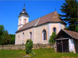
SIGNS OF INTEREST: Armensünderkapelle, remains of Blankenburg castle, St. Anna church
VIEW: In Schörgenhub view of the individual farms typical of this area
RAILWAY STATION: Neufelden
With the free app outdooractive you can hike the trail by navigation.
SIGNS OF INTEREST: Armensünderkapelle, remains of Blankenburg castle, St. Anna church
VIEW: In Schörgenhub view of the individual farms typical of this area
RAILWAY STATION: Neufelden
With the free app outdooractive you can hike the trail by navigation.
- All weather
- Pets allowed
- Spring
- Summer
- Autumn
Please get in touch for more information.
Markt 22
4120 Neufelden
Phone +43 5 7890 - 100
Fax machine +43 5 7890 - 115
E-Mail info@boehmerwald.at
Web www.boehmerwald.at
https://www.boehmerwald.at
You can also visit us on
Visit us on Facebook Visit us on Instagram Visit our videochannel on YouTubeInteractive elevation profile
Create PDF
Tour-Details
Path number: 32
Starting place: 4120 Neufelden
Destination: 4120 Neufelden
duration: 3h 34m
length: 11,9 km
Altitude difference (uphill): 316m
Altitude difference (downhill): 318m
Lowest point: 452m
Highest point: 616m
difficulty: medium
condition: medium
panoramic view: Individual Views
powered by TOURDATA
