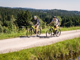
Panorama cycle route


- Flatly
- Possible accommodation
Interactive elevation profile
Create PDF
Tour-Details
Path number: 807
Starting place: 4160 Aigen-Schlägl
Destination: 4160 Aigen-Schlägl
duration: 5h 0m
length: 45,0 km
Altitude difference (uphill): 710m
Altitude difference (downhill): 684m
Lowest point: 489m
Highest point: 767m
difficulty: difficult
condition: difficult
panoramic view: Dreamtour
Paths covering:
Asphalt
powered by TOURDATA
Beautiful cycling route in the Šumava holiday region for enduring cyclists! 0 km The start is at Schlägl Abbey. Cycle straight ahead over the
roundabout. At the petrol station, cycle straight on uphill to...
2.7 km to St. Wolfgang (pilgrimage church). Continue straight ahead along the Oberneudorf goods road.
3.6 km In Oberneudorf continue left and downhill through the village of Haugsberg and past the Chico company (hammock production). Leave Obergrünau on the left and pass the sports facilities. Take not the goods road Berlesreith and you will soon be in...
6.5 km Oepping. Cycle straight through, past the primary school and cycle to...
7.1 km on the B38 main road. Cross the road here and continue immediately to the left on the side road. Then straight on to the...
7.6 km junction (please give way). Continue right here to...
8.9 km to the village of Oberfischbach. Turn left here, then straight ahead (not to Gerri's Garage) downhill into the valley of the small stream. Now uphill and continue left at the fork in the road. You will soon see the...
9.8 km federal road B38. Before that, turn right towards Rohrbach-Nord/Berg and cross the bridge over the main road. Cycle moderately uphill to the houses of...
10.6 km Wandschaml. Here, cycle right downhill into the hollow and continue uphill to the junction with...
11.2 km Harrauerstraße. Continue left here. Stay on Harrauerstraße. You will see the Villa sinnenreich on the left and the kindergarten on the right before turning right into Bahnhofstraße and soon reaching the...
12.4 km Rohrbach-Berg town square. Before the Trinity Column, turn right into Hanriederstraße and continue straight ahead on this road over the bridge over the main road and straight through the shopping centre to the...
13.7 km village of Lanzerstorf. At the end of the village, the cycle route leads right to Götzendorf. First downhill into the valley of the Fischbach stream, through the sawmill and uphill again to...
16.6 km to Götzendorf. In the village, after the mirror, turn right onto the Obergahleiten goods road and immediately left again towards Peherstorf. Cycling downhill, you will soon reach Rumerstorf. Turn right here onto the Mühltal goods road, first downhill then briefly uphill to...
18.2 km Peherstorf Straight through, downhill and uphill to Obermayrhof. Turn left here and cycle downhill into the valley of the Kleine Mühl river and continue uphill along the Sixlmühle estate road to...
21.0 km Rutzersdorf (Brezerhaus - listed farm). Turn right here towards Hennerbach and continue along the Schölling estate road, climbing moderately to...
22.0 km to Hennerbach. Take the bypass on the right and continue straight on to Peilstein on the Rampetzreith estate road. Ascending through the forest, you reach the village of Rampetzreith...
23.4 km Continue straight ahead here. Enjoy the wonderful view of the Bohemian Forest. The tour leads downhill to...
24.5 km Vordorf and on towards Peilstein. At the junction with the main road, turn right and then immediately left onto the B38 towards Julbach (the Hubertushof inn is about 100 metres away on the B38). Cycle past the Hehenberger company on a moderate ascent past the village of Martschlag to the
junction Höhlschmiede/Egermühle. Here you turn left onto the Höhlschmiede estate road and cycle over the small bridge past the house on the right to the fork. Turn left here (not to the Lauss sawmill) uphill and you will soon reach the road junction. Continue right here and you will soon be in Niederkraml and then cycle on to Julbach.
33.0 km In Julbach at the junction with the crossroads opposite the fire station, turn left into the main road and cycle straight on through the village. Take the right-hand bend, cycle past the petrol station, don't turn off to Bräuerau, but cycle straight on briefly until you reach Höhenstraße. Turn right here towards Ödenkirchen. The path leads uphill to the so-called Zwischenmühlrücken on the panoramic road (on the left the valley of the Große Mühl with the Bohemian Forest in the background and on the right the valley of the Kleine Mühl). Continue straight on through the villages of Präuer, Ober- and Unterthiergrub. Then don't go to Kirchbach but continue to...
39.5 km Ödenkirchen. Here you don't turn off to Ulrichsberg but follow the signpost to Schlägl and cycle down the valley past the villages of Zaglau and Kerschbaum to...
45 km starting point Aigen-Schlägl.
Request our bike map for EUR 3.00!
With the free app outdooractive you can follow the route by navigation.
Starting point: Schlägl Abbey.
Destination: Schlägl Abbey.
further information:
- Flatly
- Possible accommodation
- Board possible
Most economical season
- Spring
- Summer
- Autumn
Please get in touch for more information.
Hauptstraße 2
4160 Aigen-Schlägl
Phone +43 5 7890 - 100
Fax machine +43 5 7890 - 115
E-Mail info@boehmerwald.at
Web www.boehmerwald.at/
https://www.boehmerwald.at/
You can also visit us on
Visit us on Facebook Visit us on Instagram Visit our videochannel on YouTube")
")
")
")

")
")
")
")

Mühlviertel Marken GmbH-Enzenhofer)")
")
Interactive elevation profile
Create PDF
Tour-Details
Path number: 807
Starting place: 4160 Aigen-Schlägl
Destination: 4160 Aigen-Schlägl
duration: 5h 0m
length: 45,0 km
Altitude difference (uphill): 710m
Altitude difference (downhill): 684m
Lowest point: 489m
Highest point: 767m
difficulty: difficult
condition: difficult
panoramic view: Dreamtour
Paths covering:
Asphalt
powered by TOURDATA
