Schmugglersteig


- Flatly
Interactive elevation profile
Create PDF
Tour-Details
Path number: 14
Starting place: 4154 Kollerschlag
Destination: 4154 Kollerschlag
duration: 3h 30m
length: 12,0 km
Altitude difference (uphill): 250m
Altitude difference (downhill): 257m
Lowest point: 587m
Highest point: 715m
difficulty: medium
condition: medium
panoramic view: Great panorama
Paths covering:
Asphalt, Hiking trail
powered by TOURDATA
Cross-border hiking trail (Bohemian Forest vacation area and Germany) with several access points.
0 km You start at Rathaus Wegscheid (DE) and walk eastwards on the pavement opposite. Continue straight ahead at Adalbert Stifterweg and Ebenäcker Weg and past the hospital.
Do not overlook the turn-off on the right at the 30 km/h sign (police); the path now runs parallel to Mühlenweg (no. 2) and Seeweg (no. 4). Now turn right past the former customs house (yellow building), do not join Waldweg 9-12. You come to the old sports field, where you take the left branch of the path twice. Shortly afterwards, leave the tarmac road and turn left downhill onto the forest path (signpost "GH Heindlmühle" at the tree). The colour markings 2+4 on the tree show the way. You will pass an old dilapidated house and will soon reach...
1.7 km Gasthaus Heindlmühle. Now continue left along the tarmac road and soon reach the Wegscheid-Kollerschlag road. On the right you can already see the...
2.4 km border crossing to Austria (Hanging), which you pass. There is an overview board and rest area here! Take the little-used road to...
4.0 km Fuchsödt. There is a shortcut over the bridge here. Continue straight on to the Templmühle sawmill and turn right here onto the road to Haselbach. Immediately afterwards, the...
4.6 km connecting path from Kollerschlag joins the road. The road to Haselbach now leads through the forest and the Grenzbach stream flows in the valley to the right. Once you reach the idyllic village of...
6.0 km Haselbach, follow the hiking trail sign to the right, past the Resch car repair shop. You will see the pretty little chapel in front of you and walk past it on the left. After about 25 metres, turn right onto the field path and leave the Bärnlochweg. At the next fork in the path, take the right-hand branch which leads downhill to the forest. At the end of the forest, walk right along the edge of the forest to the...
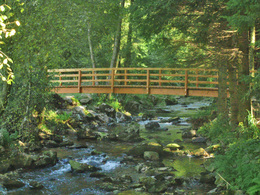
6.8 km wooden bridge. You cross the Grenzbach stream. There is a bench at this idyllic spot. Continue straight ahead past the "Säge" information board. The tarmac road leads uphill to the...
7.3 km village of Fronau. Turn right here. A memorial stone and bench invite you to linger. Immediately afterwards, the former Fronau customs house is on the right. An agricultural and forestry road continues straight ahead. A beautiful section of forest and the bee nature trail accompany you
9.0 km When you reach the end of the forest path in Steinmühl (opposite Fuchsödt - bridge), turn left at the crossroads onto the tarmac road and walk past the Stockinger power station and shortly afterwards the sewage treatment plant. The path now leads straight uphill.
9.5 km At the small Bühel turn right to the Jägermühle. (Shortcut option to Wegscheid). At the Jägermühle (information board), turn left onto a beautiful country lane. The forest path that follows takes you directly to...
10.3 km Gasthaus Heindlmühle. The uphill section (same as at the start) takes you back to...
12.0 km Wegscheid.
Request our hiking map for EUR 3.00 and the hiking diary for EUR 5.00!
With the free app outdooractive you can hike the trail by navigation.
0 km You start at Rathaus Wegscheid (DE) and walk eastwards on the pavement opposite. Continue straight ahead at Adalbert Stifterweg and Ebenäcker Weg and past the hospital.
Do not overlook the turn-off on the right at the 30 km/h sign (police); the path now runs parallel to Mühlenweg (no. 2) and Seeweg (no. 4). Now turn right past the former customs house (yellow building), do not join Waldweg 9-12. You come to the old sports field, where you take the left branch of the path twice. Shortly afterwards, leave the tarmac road and turn left downhill onto the forest path (signpost "GH Heindlmühle" at the tree). The colour markings 2+4 on the tree show the way. You will pass an old dilapidated house and will soon reach...
1.7 km Gasthaus Heindlmühle. Now continue left along the tarmac road and soon reach the Wegscheid-Kollerschlag road. On the right you can already see the...
2.4 km border crossing to Austria (Hanging), which you pass. There is an overview board and rest area here! Take the little-used road to...
4.0 km Fuchsödt. There is a shortcut over the bridge here. Continue straight on to the Templmühle sawmill and turn right here onto the road to Haselbach. Immediately afterwards, the...
4.6 km connecting path from Kollerschlag joins the road. The road to Haselbach now leads through the forest and the Grenzbach stream flows in the valley to the right. Once you reach the idyllic village of...
6.0 km Haselbach, follow the hiking trail sign to the right, past the Resch car repair shop. You will see the pretty little chapel in front of you and walk past it on the left. After about 25 metres, turn right onto the field path and leave the Bärnlochweg. At the next fork in the path, take the right-hand branch which leads downhill to the forest. At the end of the forest, walk right along the edge of the forest to the...
6.8 km wooden bridge. You cross the Grenzbach stream. There is a bench at this idyllic spot. Continue straight ahead past the "Säge" information board. The tarmac road leads uphill to the...
7.3 km village of Fronau. Turn right here. A memorial stone and bench invite you to linger. Immediately afterwards, the former Fronau customs house is on the right. An agricultural and forestry road continues straight ahead. A beautiful section of forest and the bee nature trail accompany you
9.0 km When you reach the end of the forest path in Steinmühl (opposite Fuchsödt - bridge), turn left at the crossroads onto the tarmac road and walk past the Stockinger power station and shortly afterwards the sewage treatment plant. The path now leads straight uphill.
9.5 km At the small Bühel turn right to the Jägermühle. (Shortcut option to Wegscheid). At the Jägermühle (information board), turn left onto a beautiful country lane. The forest path that follows takes you directly to...
10.3 km Gasthaus Heindlmühle. The uphill section (same as at the start) takes you back to...
12.0 km Wegscheid.
Request our hiking map for EUR 3.00 and the hiking diary for EUR 5.00!
With the free app outdooractive you can hike the trail by navigation.
Most economical season
- Spring
- Summer
- Autumn
Please get in touch for more information.
Markt 14
4154 Kollerschlag
Phone +43 5 7890 - 100
Fax machine +43 5 7890 - 115
E-Mail info@boehmerwald.at
Web www.boehmerwald.at/
https://www.boehmerwald.at/
You can also visit us on
Visit us on Facebook Visit us on Instagram Visit our videochannel on YouTubeInteractive elevation profile
Create PDF
Tour-Details
Path number: 14
Starting place: 4154 Kollerschlag
Destination: 4154 Kollerschlag
duration: 3h 30m
length: 12,0 km
Altitude difference (uphill): 250m
Altitude difference (downhill): 257m
Lowest point: 587m
Highest point: 715m
difficulty: medium
condition: medium
panoramic view: Great panorama
Paths covering:
Asphalt, Hiking trail
powered by TOURDATA
