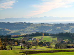
Rennradtour durch Bayern


- Flatly
- Possible accommodation
Interactive elevation profile
Create PDF
Tour-Details
Starting place: 4160 Aigen-Schlägl
Destination: 4160 Aigen-Schlägl
duration: 6h 30m
length: 102,0 km
Altitude difference (uphill): 1.648m
Altitude difference (downhill): 1.654m
Lowest point: 489m
Highest point: 871m
difficulty: difficult
condition: difficult
panoramic view: Great panorama
Paths covering:
Asphalt
powered by TOURDATA
A longer road bike tour to our neighbouring state of Bavaria.
0 km This tour starts in Aigen-Schlägl. Leave the market square in a north-westerly direction. Turn right onto the Dreisesselberg country road, which will take you to
6 km Ulrichsberg. Continue through Salnau and Klaffer am Hochficht. Approx. 2.5 km after Klaffer
turn left. The road takes you to the Austrian/Bavarian border crossing and further uphill to
17 km Breitenberg. Stay on the main road. Uphill through the villages of Klafferstraß,
Langbruck and Gsenget you reach
28 km Schindelstatt/Laßberg. Here you leave the main road to the left. Through Steinerfurth you reach Sonnen and cross the main road. You cycle downhill through several small villages to
51 km Untergriesbach. Turn right at the end of the market town. Through Lämmerstorf and Gottsdorf you reach the border between Bavaria and Austria and continue to
62 km Neustift. Turn left uphill to reach Oberkappel. Turn right before the town square and then left after approx. 400 metres. Continue uphill through Amesedt to
76 km Putzleinsdorf. Turn left at the market square. Your tour continues through Ohnerstorf up to Sarleinsbach. Turn left and after approx. 1 km turn right. Uphill through Lämmersdorf you reach Sprinzerstein. Follow the road to the left until
90 km Rohrbach-Berg. Go straight over the roundabout, keep
left and turn left onto the main road. Shortly before Öpping, turn right, the road takes you back to your starting point
102 km Aigen-Schlägl.
With the free app outdooractive you can hike the route using navigation.
Most economical season
- Spring
- Summer
- Autumn
Please get in touch for more information.
Hauptstraße 2
4160 Aigen-Schlägl
Phone +43 5 7890 - 100
Fax machine +43 5 7890 - 115
E-Mail info@boehmerwald.at
Web www.boehmerwald.at
Web www.almesberger.at
https://www.boehmerwald.at
https://www.almesberger.at
https://www.almesberger.at
You can also visit us on
Visit us on Facebook Visit us on Instagram Visit our videochannel on YouTube")
Interactive elevation profile
Create PDF
Tour-Details
Starting place: 4160 Aigen-Schlägl
Destination: 4160 Aigen-Schlägl
duration: 6h 30m
length: 102,0 km
Altitude difference (uphill): 1.648m
Altitude difference (downhill): 1.654m
Lowest point: 489m
Highest point: 871m
difficulty: difficult
condition: difficult
panoramic view: Great panorama
Paths covering:
Asphalt
powered by TOURDATA
