Michlweg


- Flatly
- Possible accommodation
Interactive elevation profile
Create PDF
Tour-Details
Path number: 76
Starting place: 4170 Haslach an der Mühl
Destination: 4170 Haslach an der Mühl
duration: 3h 30m
length: 11,5 km
Altitude difference (uphill): 190m
Altitude difference (downhill): 196m
Lowest point: 491m
Highest point: 634m
difficulty: medium
condition: medium
panoramic view: Great panorama
Paths covering:
Asphalt, Hiking trail
powered by TOURDATA
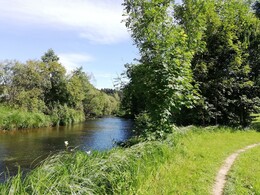
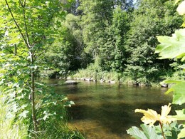
Hiking trail without steep inclines along the Große Mühl, Steinernen Mühl and the Saxenhoferbach. Perfect for family hikes!
0 km From Marktplatz Haslach towards the parish church. The Church of St Nicholas is the most impressive late Gothic church in the Upper Mühlviertel. The presbytery with ribbed vaulting dates back to around 1350 and the tower, which now stands free and was built as a defence tower, is a landmark of Haslach. Pass the church on the left, cross the steps and then turn right towards Stegmühle. After the bridge, turn right along the Steinerne Mühl. From here you have a beautiful view of the ring wall and the corner tower.
0.6 km Shortly before the next bridge, turn left in the direction of Haslach railway station. Before doing so, it is worth making a detour to the right over the bridge to the Mühlviertler Ölmühle and the Manufaktur Haslach. Linseed oil has been pressed at the Mühlviertel oil mill for more than 500 years. (Visits by prior arrangement). The Haslach manufactory can also be visited by appointment. You can see the various processing methods step by step, from the raw wool to the finished product.
You have a very good view of the imposing building of the former Vonwiller weaving mill from here, where the Museum Mechanische Klangfabrik and the Textile Centre Haslach with the Weaving Museum can be visited.
In addition, you can see the largest iron 12 metres (the mangle) in its own glass house in the garden with dyer's plants. The trail leads along the Mühl on meadow and forest paths and the last stretch of tarmac road to the ...
2.9 km ... Magerl bridge (railway station 300 m away). The Michlweg continues along the Große Mühl on the tarmac road until shortly before the Teufelmühle.
3.9 km 300 m before the Teufelmühle, turn left after the Saxenhoferbach stream on the forest path steeply uphill, along the edge of the forest for a short distance and then turn left again onto the forest path. (Possibility of a detour to the Unterkagerer monument farm.) From the rest area across the meadow to the Laahbergerteich pond, (past hop fields) along the field path on the right to ...
6.0 km ... Neudorf. The village chapel stands at the highest point of the village. It was built in gratitude because lightning struck the rock on which it stands and not the Feldler house opposite. Next to the chapel is a war memorial from 1948 (possibility for a detour to the school museum in Kasten - approx. 1.5 km). From Neudorf, continue on an asphalt road towards Turmbauer, good views to Ödt, St. Stefan and Sternstein, past the farmhouse on the left on the gravel path into Turmbauerholz, past the Stegwiese to the Holzhäusln. 7.8 km Before the Holzhäusln, turn right towards Zagelmühle on the asphalt road. Before the bridge, turn left onto the meadow path and walk along the Steinerne Mühl along the nature trail
9.9 km In Welset Pühret, continue along the banks of the Steinerne Mühl and stay on the pavement on the main road. Before the bridge, turn left towards Notarquelle to Stegmühle
11.5 km Cross the bridge to Stegmühle, continue to the church and back to the Marketplace Haslach an der Mühl.
Request our hiking map for EUR 3.00!
With the free app outdooractive you can hike / ski the trail by navigation.
Starting point: Market square Haslach an der Mühl.
Destination: Market square Haslach an der Mühl.
further information:
- Flatly
- Possible accommodation
- Board possible
")
Most economical season
- Spring
- Summer
- Autumn
Please get in touch for more information.
Stahlmühle 4
4170 Haslach an der Mühl
Phone +43 5 7890 - 100
Fax machine +43 5 7890 - 115
E-Mail info@boehmerwald.at
Web www.boehmerwald.at/
https://www.boehmerwald.at/
You can also visit us on
Visit us on Facebook Visit us on Instagram Visit our videochannel on YouTube")
")
")
")
")

")
Interactive elevation profile
Create PDF
Tour-Details
Path number: 76
Starting place: 4170 Haslach an der Mühl
Destination: 4170 Haslach an der Mühl
duration: 3h 30m
length: 11,5 km
Altitude difference (uphill): 190m
Altitude difference (downhill): 196m
Lowest point: 491m
Highest point: 634m
difficulty: medium
condition: medium
panoramic view: Great panorama
Paths covering:
Asphalt, Hiking trail
powered by TOURDATA
